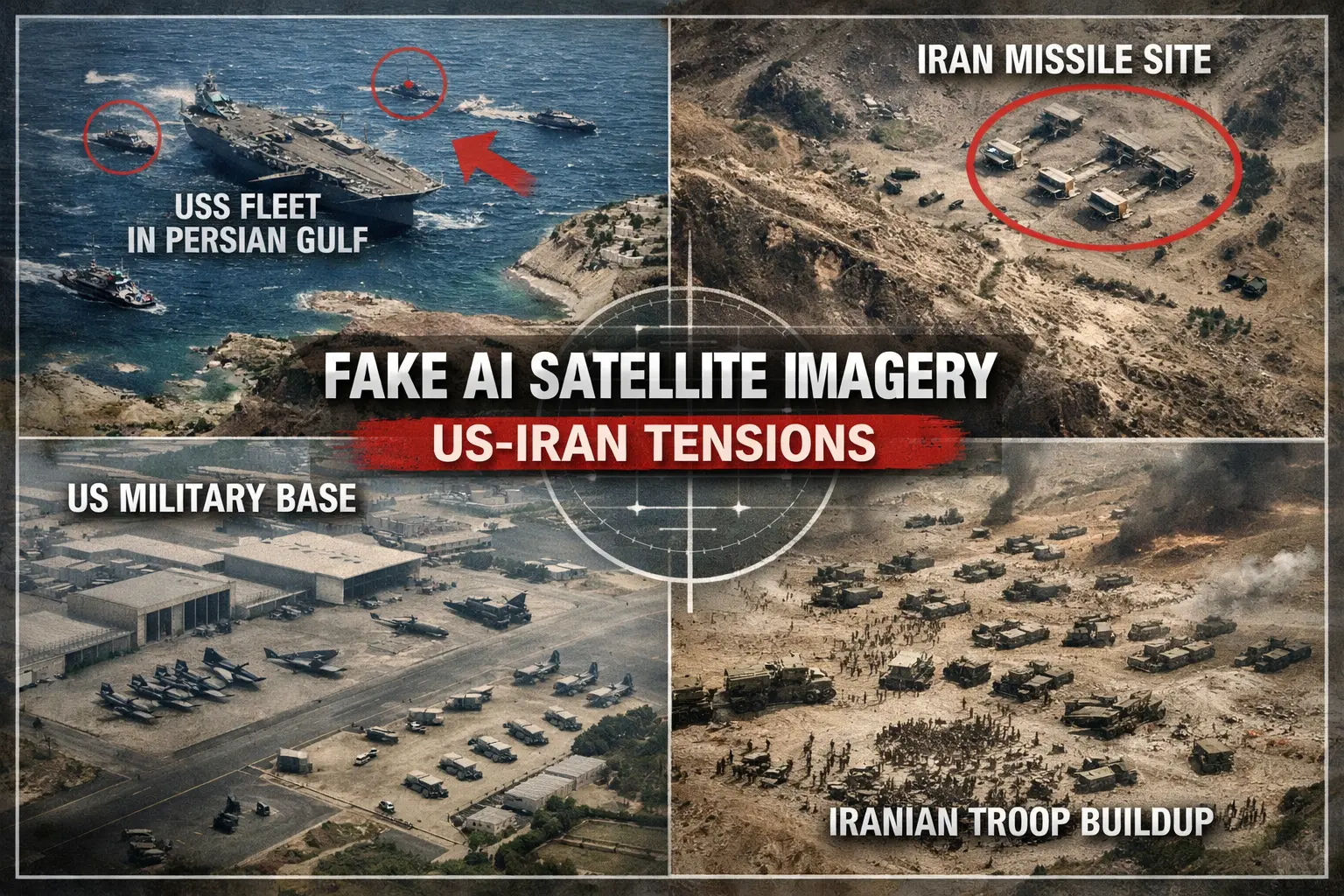
A wave of AI-generated satellite images claiming to show military activity linked to a possible war between the United States and Iran has spread rapidly across social media platforms. The images, which appear similar to real satellite reconnaissance photos, allegedly depict troop deployments, missile launch sites, and military bases preparing for conflict. However, investigators and analysts say the visuals are entirely fabricated and produced using generative artificial intelligence tools.
False Claims Amplify Geopolitical Tensions
The images were widely shared alongside posts suggesting that both nations were preparing for imminent military confrontation. Some posts claimed the visuals revealed secret intelligence about U.S. naval movements in the Persian Gulf or Iranian missile installations. Experts say such claims are misleading and designed to provoke fear, confusion, or political reactions among online audiences.
Experts Warn About the Rise of Synthetic Intelligence Imagery
Disinformation researchers say AI technology has made it significantly easier to create convincing satellite-style imagery without access to real data. By training on publicly available satellite photos, image-generation models can mimic the patterns, lighting, terrain textures, and infrastructure layouts typical of real orbital imagery. The result can appear highly authentic to untrained viewers.
Open-Source Analysts Quickly Debunk the Images
Open-source intelligence (OSINT) communities and fact-checkers quickly identified inconsistencies in the viral images. Analysts noted unrealistic shadows, duplicated terrain features, and infrastructure layouts that did not match verified geographic locations. Some images also included military equipment that appeared distorted or incorrectly scaled, a common artifact in AI-generated visuals.
Social Media Algorithms Accelerate Spread
Despite being false, the images spread quickly across platforms such as X, Telegram, and Facebook. Researchers say the viral nature of sensational geopolitical content allows misinformation to reach millions before corrections appear. Posts containing dramatic claims about military conflict tend to attract high engagement, which algorithms often amplify.
Growing Concern for National Security
Security analysts warn that synthetic imagery could increasingly be used in information warfare campaigns. Fake satellite photos may be deployed to manipulate public perception, influence diplomatic tensions, or undermine trust in legitimate intelligence reports. Governments worldwide are becoming more concerned that such tools could be exploited during crises or military standoffs.
Calls for Verification Tools and Media Literacy
Experts say countering the problem will require both technological and educational responses. Verification systems that analyze metadata, detect AI artifacts, or cross-reference satellite data could help identify manipulated imagery. At the same time, researchers emphasize the importance of improving digital literacy so that users question viral images claiming to reveal secret military activity.
A New Challenge in the Age of Generative AI
The spread of fake satellite imagery illustrates how generative AI is reshaping the information landscape. As the technology becomes more advanced and accessible, distinguishing real intelligence from fabricated visuals will become increasingly difficult. Analysts warn that without stronger safeguards, synthetic media could play a larger role in future misinformation campaigns tied to global conflicts.